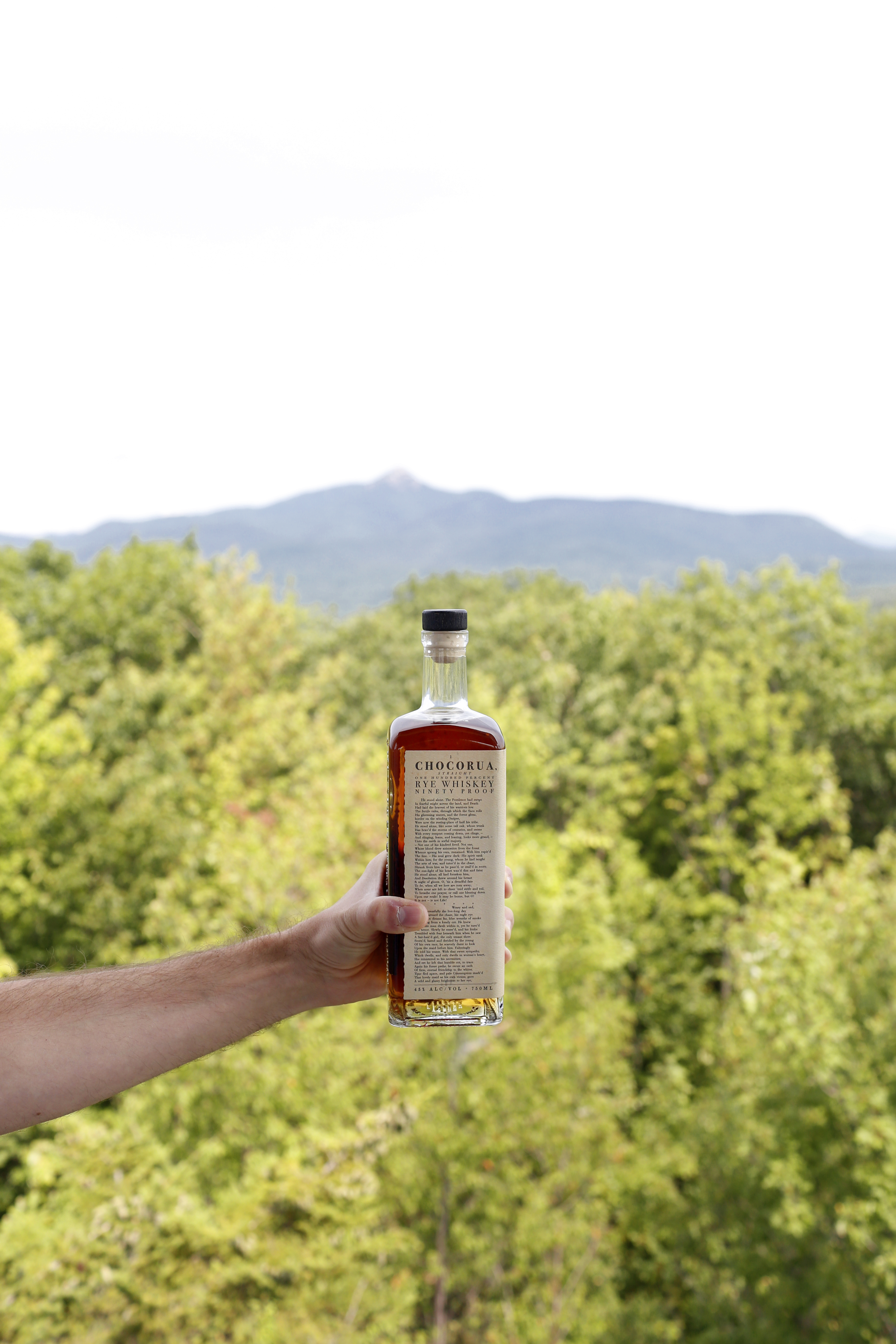
Our latest spirit, Chocorua Straight Rye, is named after the legendary mountain that bears the same name – Mt. Choroua. With its bare peak visible from almost every direction, Mt. Chocorua is iconic. It is the subject of landscapes by poet E.E. Cummings, poems by Wallace Stevens, sonatas by Alan Hovhaness, and is the most photographed summit in the White Mountains. Here are some of our favorite, stories, poems, and paintings also inspired by this landscape.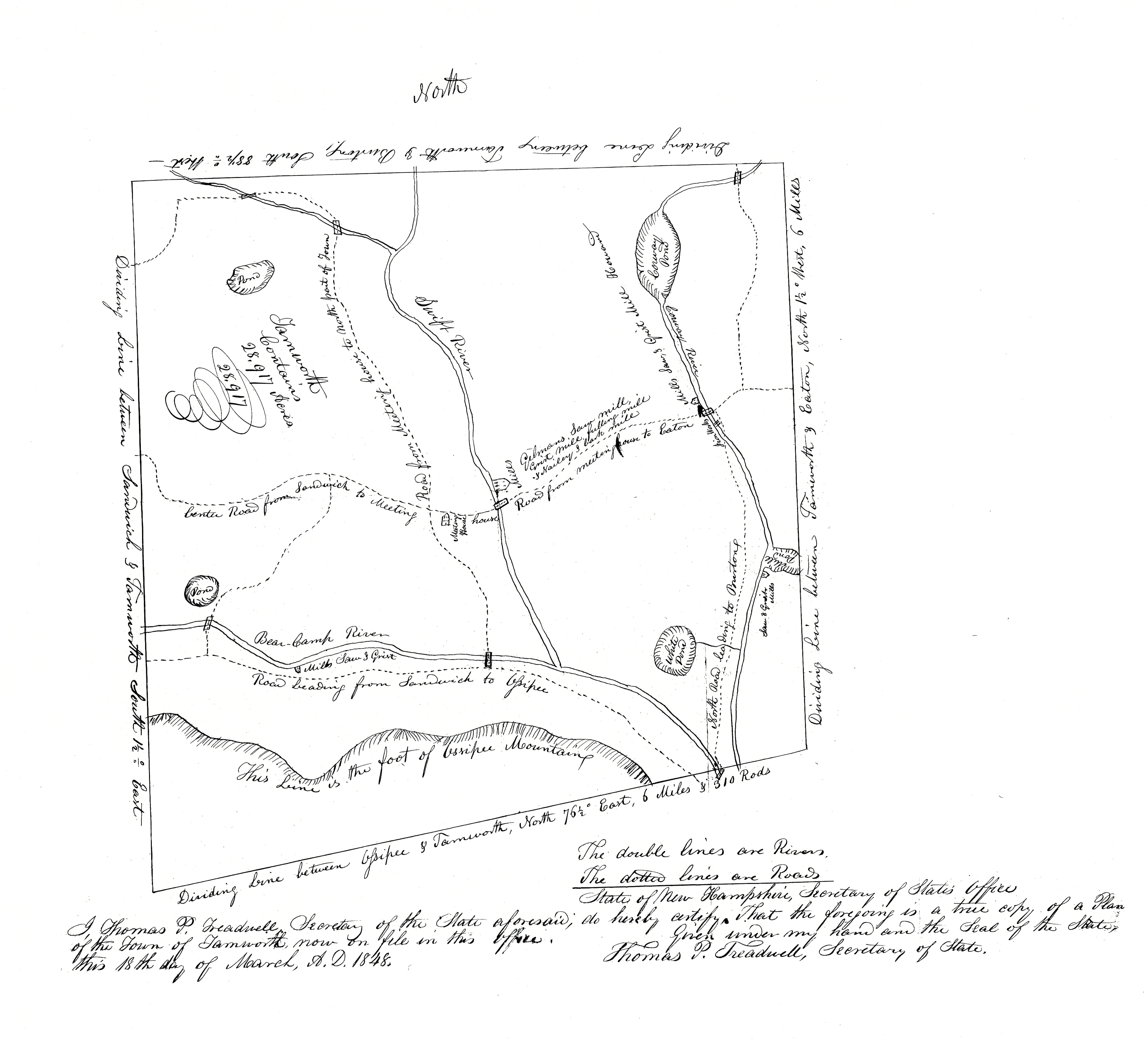
Tamworth: 1848
In 1766, Tamworth was granted a charter by England’s King George III. Early settlers began to build homesteads and planted the first crops — nearly all were farmers, growing corn, wheat, and rye. Gristmills soon began turning, powered by the town’s rivers and streams.
This map, drawn just 82 years later in 1848, illustrates Tamworth’s landscape in its early days. Only the features of most importance to the community are marked: Meeting House, mills, roads, rivers, and ponds. Roads are labeled in their relation to the Meeting House or which other town they lead to—roads that still exist today, now named for families that in 1848 were just settling or had yet to settle in Tamworth.
Lake Chocorua is drawn in the upper right-hand corner and labeled as “Coruway Pond,” as it was known until later in the 19th century. The area that is now known as Chocorua was at the time called Tamworth Iron Works, thanks to the iron factory that, according to local lore, forged the first anchor in the United States [2]. The iron works are marked on this map at the intersection of the “Coruway (Swift) River” and what is now Route 113.
Chocorua is not the only town to have changed its name over the centuries — Madison to the East is here called Eaton, and Albany to the North is labeled as Burton.
At the bottom of the map is written: “State of New Hampshire, Secretary of State’s Office”
“In the meantime, he had located three of the corners that Beede had shown him on the plan of the town, and keeping in mind how they bore from Coruway Mountain, he could always tell where he was with regard to that plan…
If the clouds weren’t too low, it was no trouble to find it. He could go up a tree anywhere, and as soon as he’d get high enough…there the mountain would be… There wasn’t a minute that he didn’t have the mountain in mind… Coruway Mountain was a thing you could count on.
There was no other like it that he’d ever seen. The lower part, maybe, was like other mountains. But the gray, granite peak of it, solid and strong and alone in the sky…well, that was a thing that you saw and then felt. And once you had felt it, you could see it again just by shutting your eyes—see it more clearly than you could remember a face,—most faces, at any rate.
…But in the matter of spirits—well, that was a difficult thing. It was a thing that had troubled him always about Coruway Mountain, from the first time that he’d seen it. The spirits were there on the mountain. There was no question of that.
…Yet whenever he looked at Coruway Mountain it made him feel good. It was always that way. And he’d had the feeling a good many times that the mountain was friendly—not in a sociable, talkative way, but in a bigger way than that. He’d even felt himself drawn to it.
…And he thought of proof that the mountain was friendly. Any time, anywhere, a man that could see it could tell where he was…All he had to do was climb up a tree and take a look at the mountain—and the mountain would tell him what he wanted to know. If that didn’t show that the mountain was friendly—well, then nothing would.” [1]
The Naming of a Village
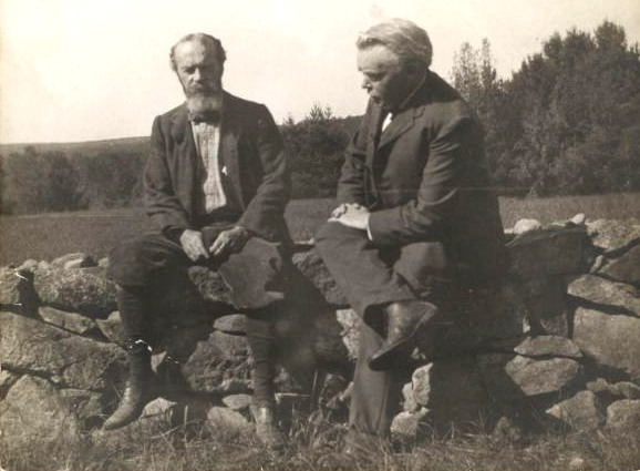
By the end of the 19th century, the area surrounding Chocorua Lake was firmly established as the refuge for a summer community of intellectual elite, primarily Harvard professors, who started buying up property for summer cottages and continued to do so through the early years of the 1900’s. Many of these houses still exist today and were instrumental in getting the Chocorua Lake Basin Historic District listed on the Register of National Historic Places in 2005 (the largest of its kind in New England, the district covers more than 6,000 acres surrounding Chocorua Lake [3] ). Among the number of those who fled the city was the American philosopher and psychologist William James (1842-1910). James once wrote to a friend, in reference to the beautify of the area:
“Scenery seems to wear in one’s consciousness better than any other element in life…It stands out as almost the only thing in the memory of which I should like to carry over with me beyond the veil, unamended and unaltered.” [4]
According to one theory, James also played a primary role in having the village’s name changed from “Tamworth Iron Works” to “Chocorua.” As local history remembers it:
“You know the story of why the “Tamworth Iron Works” name was changed? I was told…that William James was twitted by his Harvard faculty colleagues about his summer place being at Tamworth Iron Works. They thought it was a terrible name, and he was apparently somewhat bothered…So William James was supposed to have gone to see John Runnells, and together they went over to see [president] Grover Cleveland, and told him the problem. And he said, “All right, if you want to change the name, what do you want to make it?” Apparently they hadn’t thought about that, and one or the other of them said, “Chocorua.” And Grover Cleveland said, “All right, I think I have enough influence in Washington,” and he sent a telegram…The next day, they got a notice that the name was changed to “Chocorua.” That was apparently very late in the summer…around 1890.’ [5]
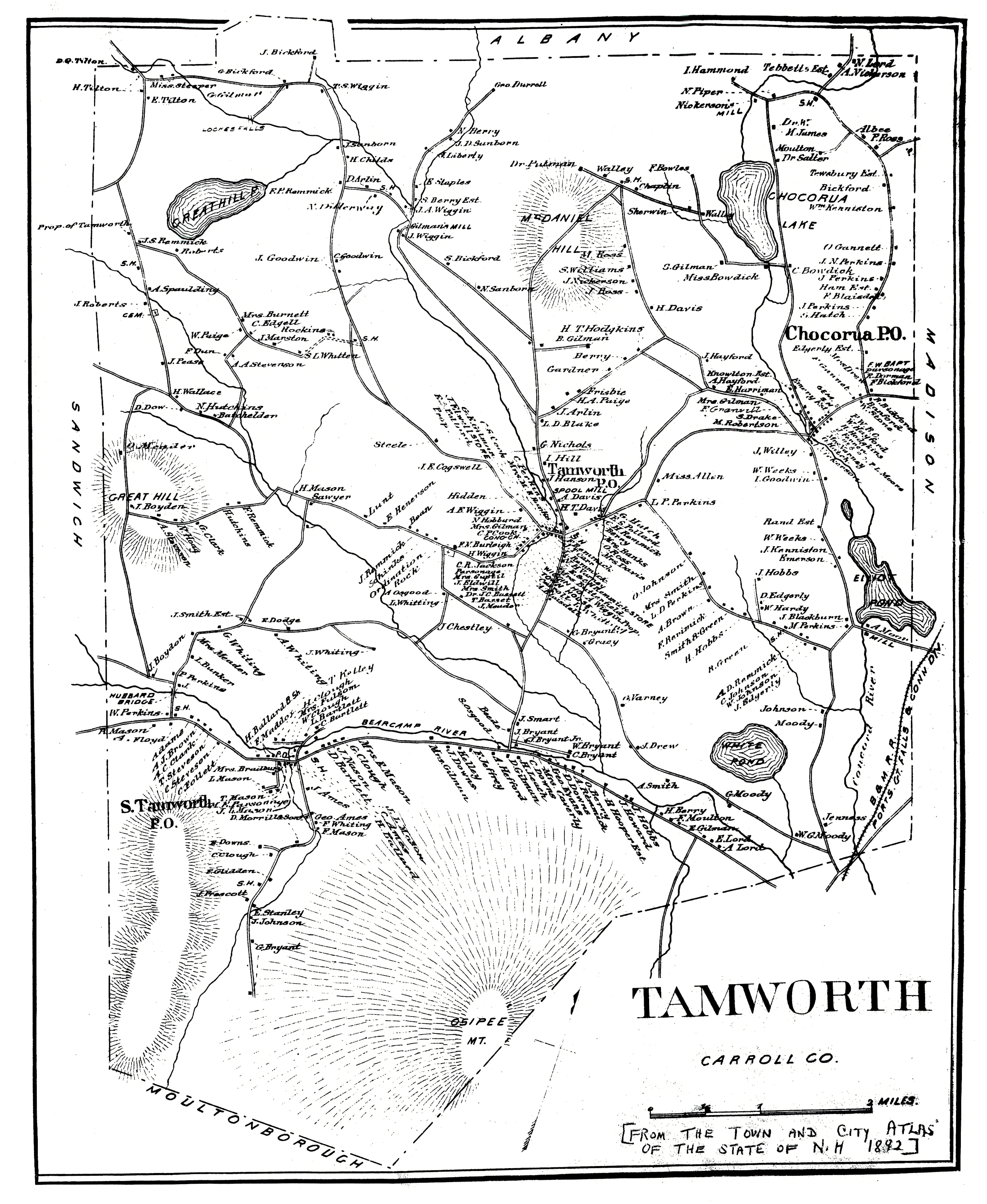
Tamworth: 1892
This is a census map of Tamworth taken from the town and city atlas of the State of New Hampshire of 1892, 34 years after the previous map. At this point Tamworth and its environs are in the beginnings of a “Golden Age” that followed a Depression in the first half of the century due to mass migration West.
The maps has been filled out considerably with many additional roads and more accurate depictions of ponds and mountains, indicative of the area’s growth during the second half of the 19th century—growth much aided by the arrival of the Boston & Maine Rail Road, which can be seen crossing Tamworth’s southeastern corner.
Every homestead in town is set down and labeled with the family name of its residents. In Tamworth Village, one can see the site that now houses Tamworth Distilling & Mercantile, marked as “WIGGIN HO[use]. A. Wiggin Prop.” (later the Tamworth Inn). The building that is now The Tamworth Lyceum is also visible, marked as “L.E. & C.H. Remmick [sic] STORE”.
The name “Chocorua” has now been streamlined to cover both the lake and the village, aided by the arrival of its own post office which is boldly marked—denoting its importance as one of the few connections the community had to the outer world.
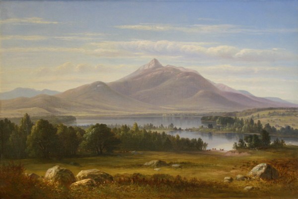
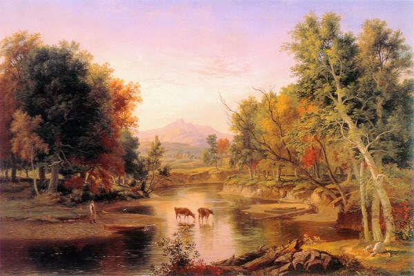
Benjamin Champney, Mount Chocorua and Chocorua Lake, 1857. Oil on canvas. From White Mountain Art & Artists by Henderson, John J. and Roger E. Belson. Copyright 1999-2017.
“Apostrophe to Chocorua”
Author unknown
Thou lone and shattered column! Thou dost stand
In mournful grandeur gazing o’er the land;
A gloomy past behind thee; and before,
In distance vast, the sullen surges roar.
Thy silence and thy aspect correspond,
And indicate a weird and ghostly bond,
Whereby thy stern black peak feels human woe,
Thy lava veins with human passions flow.
The mountains in the west have thrust thee out
From their companionship, and all about
They keep a solemn watch that thou dost stay
An exile from their grim and awful company.
For what fell deed or what mysterious crime
Did these huge forms call thee to court sublime?
Didst thou above them daringly aspire
And first receive the lightning’s lurid fire?
No answer comes. Chocorua silent stands
Forever gazing out across the lands
Where once the Indian chieftain roved
Who gave it name, and its stern wildness loved. [6]
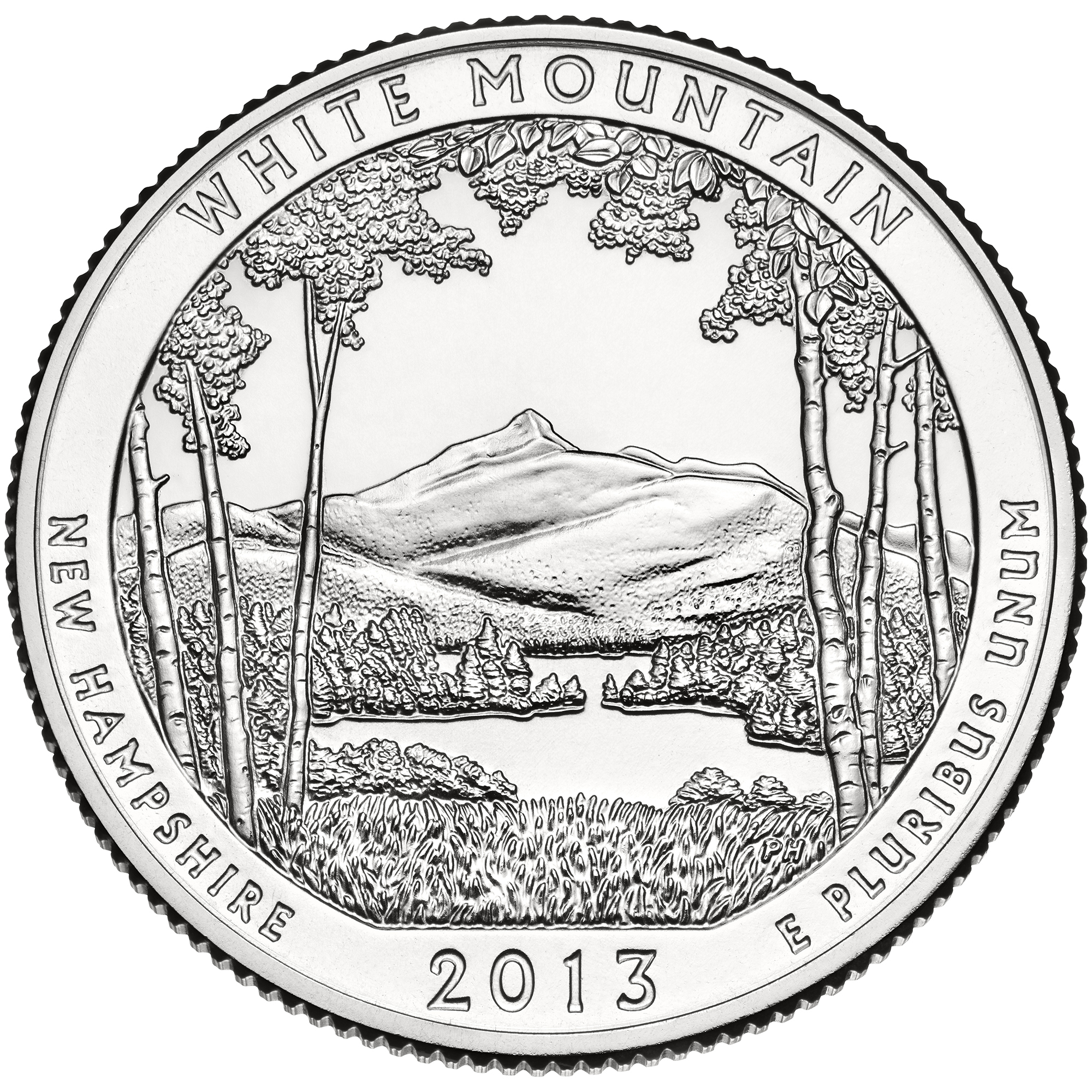
A Token for the White Mountains
White Mountain National Forest Quarter, sculpted by Phebe Hemphill. 2013.
In 2013 Mount Chocorua was chosen to be the face of the White Mountain National Forest and the state of New Hampshire on the 16th quarter of the America The Beautiful Quarters Program. The reverse side of the quarter depicts the iconic peak of Chocorua framed by birch trees.
The White Mountain National Forest, located in both New Hampshire and Maine, provides unique and strikingly beautiful landscapes and is one of America’s most visited national forests for its wide array of recreational opportunities and rich natural resources. [7]
Citations:
[1] From Chapter 10 of Look to the Mountain by LeGrand Cannon, Jr. Copyright 1942 by Holt, Rinehart and Winston. Reprinted 1970 by LeGrand Cannon, Jr.by permission of Henry Holt and Co., Inc. Pp. 66-70. Cannon had a family home in Chocorua and placed his classic work of fiction, set in 1760’s-70’s, on the landscape that he knew and loved so well.
[2] Thomas P. Treadwell, Secretary of the State aforesaid, do hereby certify that the foregoing is a true copy of a Plan of the Town of Tamworth now on file in this office. Given under my hand and the Seal of the State, this 18th day of March, A.D. 1848 Thomas P. Treadwell, Secretary of State. Lucy R. Balch, “Chocorua Fifty Years Ago” 1930. Cited by Smith, Smith, & Moot in “Chocorua Recalled” 1996, p. 17.
[3] From The Chocorua Lake Conservancy official website, https://www.chocorualakeconservancy.org/land-conservation-2/chocorua-lake-basin-historic-district/
[4] As quoted in the Maine Coast Heritage Trust, Annual Report for 1994. Cited by Smith, Smith, & Moot in “Chocorua Recalled” 1996, p. 15.
[5] Firsthand account from John F. Woodhouse, collected by Smith, Smith, & Moot in “Chocorua Recalled” 1996, p. 17.
[6] From The History of Carroll County, 1632-1889. Cited by Smith, Smith & Moot in “Chocorua Recalled.” P. 129.
[7] From the United States Mint website, Coin and Medal Programs, America The Beautiful Quarters. 2016. https://www.usmint.gov/coins/coin-medal-programs/america-the-beautiful-quarters/white-mountain-national-forest#


